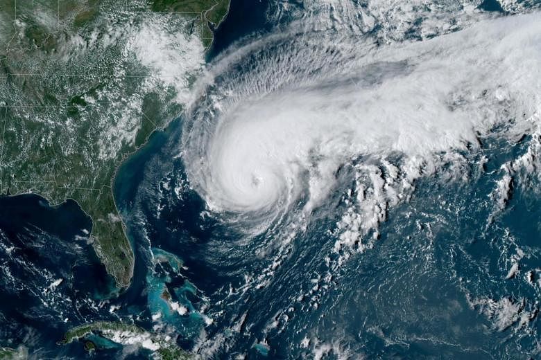
MIAMI (AP) - Hurricane Humberto grew into a powerful Category 3 storm on Tuesday evening (Sept 17), and officials on Bermuda made plans for early shutdowns of schools, public transportation and government offices on the British Atlantic territory ahead of the storm's likely close pass on Wednesday.
Tropical Storm Imelda, meanwhile, swept ashore on Texas' Gulf coast threatening to deluge parts of Southwest Texas and southwestern Louisiana with up to 46 centimetres of rain over the next few days.
It was the first named storm to hit the Houston area since Hurricane Harvey's heavy rains flooded more than 150,000 homes around the city and caused an estimated US$125 billion (S$171.86 billion) in damages in Texas.
In Bermuda, National Security Minister Wayne Caines told reporters that schools, government offices and ferries on the island would close at noon on Wednesday and bus service would end at 4pm as officials got ready for Humberto.
Officials said tropical storm-force winds were expected to start hitting Bermuda, with hurricane-force gusts, starting about 3pm on Wednesday and lasting until about 4am on Thursday.
Humberto was predicted to pass just to the north of Bermuda, but a small shift in track could bring the storm over the island itself.
The US National Hurricane Centre said Humberto's maximum sustained winds had strengthened to about 185kmh on Tuesday evening and would probably remain a Category 3 hurricane through Thursday.
The storm was centred about 655 kilometres west-southwest of Bermuda and moving to the east-northeast at 19kmh.
Bermuda was expected to see rainfall of up to 10 centimetres, with large swells along the coast.
Meanwhile, Tropical Storm Lorena formed off Mexico's Pacific Coast, and forecasters predicted heavy rains and flooding by Thursday, likely without it reaching hurricane force.
Lorena had top winds of 85kmh on Tuesday evening.
It was centred about 315 kilometres south of the resort town of Zihuatanejo and was moving northwest at 24kmh.
A tropical storm warning was in effect for the coast between Zihuatanejo and Cabo Corrientes.
Two other tropical storms, Kiko and Mario, were farther out in the Pacific and posed no threat to land.
Tropical Depression Ten also formed far out in the Atlantic and could become a hurricane on Friday as it nears the outermost Caribbean islands.