

SINGAPORE - The downpour that drenched Ulu Pandan last Saturday (April 17) was the highest daily rainfall for April recorded islandwide since 1980, the National Environment Agency (NEA) noted on Wednesday.
Rainfall of 170.6mm was recorded in a single day - around 110 per cent of the Singapore climate station's average amount for the whole month of April.
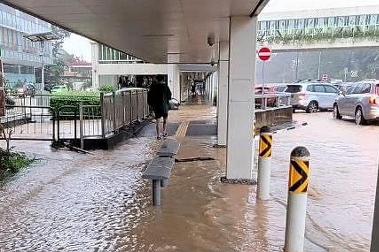
The prolonged and intense rainfall across the island on Saturday caused flash floods in several places.
Over 100mm - more than half of April's average monthly rainfall - was recorded at several locations, including Pasir Panjang, Buona Vista, Tuas and Bukit Timah between 11am and 4pm.
Saturday's rain was from a Sumatra squall, coupled with convergence of surrounding winds arising from the influence of typhoon Surigae near the Philippines, the NEA said.
Sumatra squalls usually affect Singapore between the early hours and morning, and commonly occur from April to November, when there is a higher incidence of westerly and south-westerly winds over the surrounding region.
The southern and western parts of Singapore received the highest rainfall on Saturday.
National water agency PUB told The Straits Times that drains and canals in several locations in western Singapore exceeded 90 per cent capacity.
Flood-risk warnings were issued for 25 locations. The public was told to avoid those areas although traffic remained passable.
There was flooding on footpaths in Dunearn Road and at Sime Darby Centre near Bukit Timah Canal, as well as the park connector next to Ulu Pandan Canal.
The PUB said it has been carrying out drainage improvement works to improve flood resilience of the Upper Bukit Timah catchment and to cope with the threat of more intense storms brought about by climate change.
It completed upgrading at Bukit Timah First Diversion Canal in 2019 and increased its capacity to take in 30 per cent more rainwater.
Water level sensors along the drainage network showed that the expanded canal was able to divert stormwater and lessen the impact of flash floods during Saturday's heavy rain, said the PUB.
The agency added that there are ongoing works on a 900m stretch of the Bukit Timah Canal between Rifle Range Road and Jalan Kampung Chantek.
The section will be widened from 10m to 12m, and deepened by 1m to 2m by early 2024.
Bukit Timah Canal will then be able to cope with the same rainfall intensity experienced on Saturday, said the PUB.
It added: "We have made significant progress since the 1970s, reducing the size of flood-prone areas from 3,200ha to just 28ha."